Castlemaine is located between Ballarat and Bendigo and is located in Central Victoria. Castlemaine has many cultural festivals and activities during the year and has many delicious restaurants. It’s only 1-hour drive from Melbourne making it a great day trip. Click the link here to find out more about the Restaurants in Castlemaine.

Langs Lookout
Castlemaine Botanical Gardens
The gardens are located in Castlemaine and have a 1.8km walking track around the gardens. The gardens are one of the oldest gardens in regional Victoria and were established in 1860. It’s a beautiful place to explore and have a picnic.


Castlemaine to Maldon Rail Trail
The trail is 17.7km and it takes about 2hours one way. The main point of interest is the beehive mine in Maldon off reef Street. The trail runs beside the Goldfields railway track. The Goldfields train generally runs through December and the first two weeks of January if weather permits and adult tickets start from $35 one way. The train departs from Castlemaine at 11:30 am and leaves Maldon at 2:45 pm. Check out the website( here) for more information.


Castlemaine to Campbells creek trail
The Campbells Creek trail runs from forest Street near the botanical gardens to Campbell’s Creek Park. There is a slight detour where the path doesn’t continue along the creek. The trail is a 6.6km return trail and is great for a short ride or a walk in nature along the creek.


Mount Alexander
Mt Alexander Regional Park consists of 1400 hectares of forest the mountain is 742 meters above sea level. It’s approximately 30 kilometers south of Bendigo and is the highest, coldest and wettest area of the Bendigo region. You can easily drive up to each of these lookouts, then take a short walk to the viewpoint.

Leanganook picnic And Campground
This is a great base for Castlemaine as it’s only a 20-minute drive into town. It’s located in Mount Alexander Regional Park and located right at the beginning of most of the walks. The campground has toilet facilities but no drinking water or a dump point. The closest dump point and fresh water are located in Harcourt. There is also a free hot shower located here.

Ed’s Seat Lookout
Was put together from leftover koala Park parts, from the conservation volunteer crew. It has magnificent views to the west with hugs Granite slabs. The path from Leanganook Picnic and campground is a fairly easy 1.3km one-way trip to the lookout. The path is marked with arrows which form part of the Goldfields trail.

Ed’s Seat

Dog Rocks
If you follow the same path to the left it will lead you to dig rocks. It is a 1.3km one-way trip and you can return via the same track or take the west Ridge trek back to camp. Dog rocks were given the name by Lockhart Morton who was the manager of Sutton grange station in 1846 because of the dingo’s that came through the area. Dig rocks are an area of tall Granite rocks that tower above. There also are a few Caves to explore too.


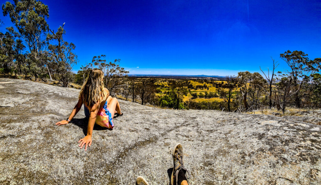
Lang’s Lookout
Is located on the eastern side of the mountain and gives spectacular views over the sutton grange farmland, Mt Ida, and Bendigo.

Warburton Bridge Campground
Warburton bridge campground Located 15 minutes from Castlemaine. The campground is located right on Loddon River. The campground has no fresh water but it has toilet facilities and dogs are allowed. The campground is located right near Vaughan Springs check out the blog Here.


Expedition Pass Reservoir
A great place to swim, kayak, or have a picnic. There is also an unofficial path around the Reservoir which is quite easy to follow.


